


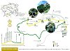
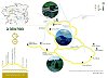
- L'Alt Berguedà
- Services
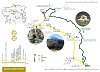
- Interest places
- Hiking
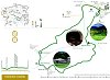
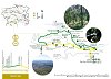
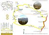
- Routes
- Quality
- Latest news
- Links
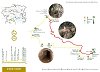
- Discount Card
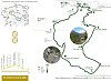
- Geocaching Alt Berguedà
-
amb la participació de


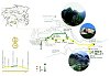
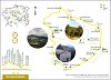
Recommended itineraries

|
Family |
|
Everyone knows El Pedraforca and many also know the sanctuary at Gresolet. The other side of the road is relatively unexplored, although there are also many attractive features along the way. To climb up to the Prats pass and from there to Vallcebre on one side and to the slopes of the Ensija ranges on the other, there were two passages or passes in the rocky face, one uphill suitable for beasts of burden and another downhill, which is only passable on foot. | |
The area around Queralt has some stunning walks to offer, as well as a varied flora and fauna. It is relatively easy to see black woodpeckers, great spotted woodpeckers and griffon vultures, thanks, in the latter case, to the colony that has taken root in the neighbouring borough of Capolat. The route we propose here leaves Queralt along the old path to Espinalbet and comes back along the path made on top of the pipe that brings water to the sanctuary of Queralt. | |
The Gósol mill and Torrentsenta As Gósol only was accessible by animal until the end of the 1940s, it maintains the charm - and some drawbacks - of having been isolated from the frenzy of the modern world. Apart from the classic appeal of El Pedraforca, the village offers the guest a great variety of attractions. | |
To Queralt along the shady side The Metge torrent played a key role in the industrialisation of Berga during the 18 th and 19 th centuries. Even though there have been references in documents of the existence of mills from the Middle Ages, the boom began when part of the waters of the torrent was diverted to the town centre and the sharp change in elevation was used to install factories and mills using hydraulic power (later replaced by electricity) to operate the machines. | |
To Queralt by way of the chapels The Queralt sanctuary and ranges present an enormous variety of features: marvellous views, craggy mountains, many paths that run along both the northern and the southern face, and buildings that tell of Queralt's vocation as a site of religious pilgrimage. We suggest a short route to get to know the sanctuary and the mountain slopes on which it is set. | |
To Queralt via Sant Pere de Madrona | |
| |
Two views of Guardiola de Berguedà Guardiola is a relatively modern village which came into being thanks to the railway. But people have been living in the valley at least since the Middle Ages, as shown by the Monastery of Sant Llorenç prop Bagà. This route combines rugged scenery with extensive views of the Llobregat valley and the gentleness of riverside woodland in a walk that can be done in a morning or afternoon. | |
|
Sport |
|
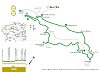
Catllaràs circuit PR-C 52 / GR - 4 | |
This area is full of spots that, not too far off, offer many surprises and curiosities. The northern section of the route is one; over a backdrop of limestone mountains with impressive shapes, this route reveals secrets of the recent and distant past of these lands. | |
| |
From Figols to Peguera - PR-C 73 The historical past of this corner of Berguedà has been marked by coal mining. On this route you will be able to see two characteristic elements of this activity: the remains of various mines and the tracks of dinosaurs. You can round off the route with a visit to the Cercs Mining Museum where you can explore this dark and little-known world in greater detail. | |
The Ensija range offers an exceptional viewpoint of the Alt Berguedà. From its highest peak, the Gallina Pelada, also known as the Cap Llitzet, you can enjoy spectacular views of the Pedraforca massif, of the Cadí range to the north and of Rasos de Peguera and Port del Comte to the south. On this occasion, we recommend you ascend by the northern slopes. | |
L'Olla de Sant Julià de Cerdanyola PR-C 129 Sant Julià de Cerdanyola is a picturesque village at the end of a broad valley and overlooking Guardiola de Berguedà from an imposing drop. As you climb up the road, the views gradually broaden to take in some of the most impressive ranges of the area. However, when you start to draw close to the village, the first thing that strikes your attention is the endless rows of stone walls marking strip fields and behind, dense forest. | |
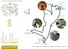
Pedraforca 360º is a route around the most magical mountain in Catalonia: Pedraforca. We suggest taking a trip round the perimeter of the mountain to discover every one of its corners. The route starts from Gósol, taking the Cerdanya path which will take you to Collell, the natural pass from the Cadí range to Pedraforca, and the dividing scarp between the Segre and the Llobregat rivers. | |
The Vallcebre Clifftop route PR-C 128 | |
To La Tosa via the Coll de Comafloriu | |
Volta per la falda del Pedraforca i la vall de Gresolet Saldes has two major attractions: El Pedraforca and Gresolet. This route gives several views of both. Even though there are long stretches of road and forest track, this is quite well compensated for with impressive views. The return is made along the Costa path, which is the old path that joined Gresolet and Saldes and is very beautiful. | |
|
Tourist |
|
From Borredà to Sant Sadurní de Rotgers Sant Sadurní de Rotgers is one of the most representative Romanesque churches in the county and has recently been restored with great care. This route follows the former Borredà path to the valley where this church is set. The age of this path affords it great intrinsic interest; the return trip is taken along more modern paths and roads, surrounded by the woods that are typical of this area. | |
Though perhaps not with such devotion as the Queralt sanctuary, the Corbera sanctuary also had its Virgin found by shepherds in a cave. The present church is from the 17th century with later annexes. At the beginning of the 20th century, it still provided a lodging service, with a room and kitchen for families staying there, and also sold religious objects. Today, it is closed most of the year and is only used occasionally as a lodge. | |
From Saldes to Gresolet (outward journey along La Costa path and return journey via the Faig spring) Saldes has two major attractions: El Pedraforca and Gresolet. This route gives you different views of the two. The outward journey is along the path of La Costa, the old path that once united Gresolet and Saldes, and is very beautiful. The return journey goes down along the Gresolet road to Cal Bessó. | |
From Vilada to Sant Sadurni de Rotgers Another route in this series describes the Sant Sadurní de Rotgers path from Borredà. Here we suggest a route to reach the church of Sant Sadurní de Rotgers from Vilada, passing by the typical pine woods of this area. The beginning of this route is the bridge at Vilada, following the waymarks of the GR 241 along a track until the first pass. From here, turn left and follow the green and white waymarks along a local path. | |
Gisclareny is a borough with a scattered population. In the middle of the 19th century, there were some 120 farmhouses scattered throughout the territory, most of them quite impoverished. Hikers at the turn of the 20th century agreed that the village was as a place where misery reigned, with subsistence agriculture - very far from the idyllic environment of today. Even so, they all remarked on the beauty of the Bastareny valley and the houses there. | |
Sant Jaume de Frontanyà PR-C 51 This route is seldom travelled and is especially outstanding because of the landscape and the variety of vegetation. It runs mainly through extensive areas of pine wood, with oaks and holm oaks on the southern face and beech on the northern face. There is only one drawback: there is no reliable water spring along the route. You must plan ahead and carry enough water to last the whole route. | |
The mining route project –undertaken jointly by the boroughs of Saldes, Guardiola de Berguedà, Vallcebre, Cercs and Fígols – seeks to restore and provide new uses for an area that was severely scarred by the coal mining industry, particularly the open-cast mines. However, you won’t see much of these scars in the route we propose here. | |
