


- L'Alt Berguedà
- How to get there
- Services
- Interest places
- Hiking
- Routes
- Tourism Information Offices
- Towns
- Quality
- Latest news
- Links
-
amb la participació de


To La Tosa via the Coll de Comafloriu

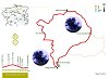

Our suggested itinerary runs completely inside the Cadí-Moixeró natural park, specifically on its most eastern side. The excursion begins at the Rebost lodge, from where you climb to La Tosa via the Coll de Comafloriu and return by way of the Coll de Jou road, the old drovers' trail that used to link El Berguedà and la Cerdanya.
Description
Leave the Rebost lodge on the GR 4.2 and 150 which leads to the Coll de Pal. Once you get on the Rebost track, you need to leave the GR markers behind to continue along a path that runs through the woods, following the orange route markers from Cavalls del Vent to past the Coll de Pal. At a certain point, you will come across the GR 150 and the Trencapinyes route markers which, if you follow them for a few metres, will take you to the President look-out point. It is well worth visiting for the stunning views.
From here, the itinerary goes on through a pine wood until you reach the Plans de Comafloriu, where the wood disappears completely. From here, you need to follow the GR 150.1 markers, which you continue to follow until you get to the Coll de Jou. The path starts climbing towards the north east in a steep slope that zigzags between stones and turf. On this stretch, the painted GR markers are complemented by milestones which make it easier to find the path. You now come to the summit of the Serrat Gran. Immediately afterwards, the path descends slightly to cross the Colladeta de Comabella, then heads upwards again to the Puig de la Comabella and finally follows the crest until you reach the Niu de l'Àliga lodge at 2,520 metres above sea level.
From here, it is worth climbing up to the summit of La Tosa, a spectacular viewing point over the Eastern Pyrenees and Central Catalonia. Montserrat, Montseny...
You should now continue along the GR 150.1. Skirting Puig de la Mena, Puig de la Canal Freda and Roca del Llamp around their northern faces, you enter a wood where the path descends sharply and then reach the Coll de Jou, where you need to leave the GR markers behind to continue on the PR 126. From here, you can get to the Penyes Altes de Moixeró, continuing towards the east; or to the Cerdanyan village of Urús, deviating towards the north.
If you follow the proposed route this time, you will find yourselves on a very interesting path: the old drovers' trail from Berguedà to the Cerdanya. This track snakes its way to L'Hospitalet with the aim of gently overcoming the steep slopes and difficult passes in the most straightforward way possible to make it easier for both animals and humans to traverse. Halfway down the descent, you will pass the side of the Roca Sança, an imposing rock to the left of the path. This is where the Our Lady of the same name was discovered, currently kept in L'Hospitalet, the village you can see at the bottom of the valley. Further on you will pass the ruins of the Claper house, which was inhabited until the 1950s; shortly after it was abandoned, a rock from the slopes of Roca Sança destroyed the building. The descent ends at the River Gréixer in the village of L'Hospitalet. After crossing it, there is just a gentle climb up a forest track with the odd dip which will bring you back to the starting point.
| Distance | 14,5 Km. |
|---|---|
| Starting point | refugi de Rebost |
| Zone | Parc Natural Cadí Moixeró |
| Time | 7 hores |
| Signals | marques taronges des de Rebost fins al coll de Comafloriu, vermelles i blanques (GR 150.1) fins a coll de Jou i marques grogues i blanques (PR 126) fins a Rebost |
| Car Park | aparcament del refugi de Rebost |
| Bibliography | Catalunya Romànica, volum XII, El Berguedà - Senders del parc natural del Cadí-Moixeró, editat pel parc natural Cadí-Moixeró |
| Ending point | refugi de Rebost |
| maximum altitude | 2520 mts. |
| Cartography | El Berguedà 1:50.000. Institut Cartogràfic de Catalunya, Moixeró – La Tosa 1:25.000. Editorial Alpina. |
| Services | Refugi Rebost, Per a altres serveis a Bagà i Guardiola de Berguedà consulteu l’apartat serveis turístics |
| Advice | En cas de realitzar la ruta en temporada hivernal cal anar convenientment equipats i portar grampons, roba i calçat adequat. |
Documentation attached
Comments

-
Maria Faura i Pedrals (13-08-2010 08:51:29) |

Unes vistes esplèndides!
